Monday, March 28. 2005
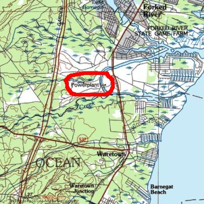
How to find nuclear power plants
About Me

Andreas Krennmair, software engineer, open-source developer, currently living and working in Berlin, Germany.
Calendar
Quicksearch
Show tagged entries
22c3 23c3 amsterdam announcement apache argentina army austria autoconf beer berlin book borland bsd c c++ camera censorship cms complaint concert cooking debian electronic music email fail feedreader fefe food fun gas mask gcc german germany git gnu golang google hacking history html http i18n imap internet israel job kaminer lecture linux linz mobile movie music network newsbeuter noos panorama pearl jam performance photo photography photos pictures podcast polaroid police politics problem programming quiz rant recommendation release rss ruby screencast seagull security series server shooting ska skabucks stfl terrorism translation travelling tv unix usa video vienna war weird wikipedia windows work wplotd youtube
Blog Administration
Links
Blogroll
• xkcd.com
• Planet Debian
• MY POV ([expect the unexpected])
• C skills
• Planet Erlang / Published News
• armstrong on software
• Photos from akrennmair
• Das Metalab informiert
• dive into mark
• /usr/local/bin
• F!XMBR
• heise online News (full feed)
• JLog
• SecuriTeam Blogs
• .:Computer Defense:.
• Riot Porn
• Chaosradio
• Radiomultikulti vom RBB: Russendisko unplugged
• AK's weblog
• The Recurity Lablog
• milw0rm.com
• seclog.de
• ilja's blag
• udo.kernecker.at - mein leben als prinzregent... ;-)
• grabnerandi.at diary feed
• Hilli's WebLog
• accidents waiting to happen
• Venzi's Weblog
• TaoSecurity
• Irrlicht3d.org
• murphee's Rant
• waiterrant.net
• grml development blog
• mutt Changelog
• nion's blog
• Wannabe Everything
• blog@bytelabs
• Knowledge Brings Fear
• Die wunderbare Welt von Isotopp
• Fefes Blog
• law blog
• mikas blog
• BILDblog
• GoogleWatchBlog
• Krone - Blog
• The Lunatic Fringe
• mp's blog
• Su-Shee 2.0
• Sex, Drugs & Compiler Construction
• Qbi's Weblog
• gedankensplitter
• Ohns Gehirnschleimschmiede
• fh
• Clifford Wolf's Blog
• AK's moblog
• Telepolis News
• Slashdot
• Newssystem von bundesheer.at
• Riding Rails - home
• Serendipity
• O'Reilly Ruby
• CCC Events Weblog
• del.icio.us/dubrider
• del.icio.us/timpritlove
• del.icio.us/ak
• del.icio.us/mika
• AK's Soup
• Friends of ak
• Astronomy Picture of the Day
• german-bash.org - Die neuesten Zitate
• QDB
• WeirdWeirdWorld Latest Feed
• I CAN HAS CHEEZBURGER?
• The Trailer Mash
• Cruel.Com
• fun.drno.de
• Peter Pilz grüner Sicherheitssprecher Österreich Wien
• NPD-BLOG.INFO
• INSM Watchblog
• Hitler-Blog
• Everybody loves Eric Raymond
• Dilbert


